Government and the World - Reading a Map (4-5)
This is the grade 4-5 (ages 9-10) version of this lesson. There are also grades 6-7 and 8+ versions on the site.
Vocabulary for this lesson:
- compass
-
compass
Sound out the word.
kum-pass
A compass is an instrument for finding directions.
It has a dial and a magnetic needle that always points to the north. - degrees
-
degrees
Sound out the word.
di-greez
A degree is a unit of measurement that is used to measure latitude and longitude on a map. - equator
-
equator
Sound out the word.
i-qway-tuh
The equator is an imaginary line around the middle of the earth.
It is equal in distance from the North Pole and the South Pole. - perpendicular
-
perpendicular

Sound out the word.
pur-puhn-dik-yuh-luh
A line is perpendicular if it meets or crosses another completely straight line at a right angle (90°).Example:

The vertical and horizontal lines cross completely straight.
They are at 90° angles.
This means they are perpendicular.
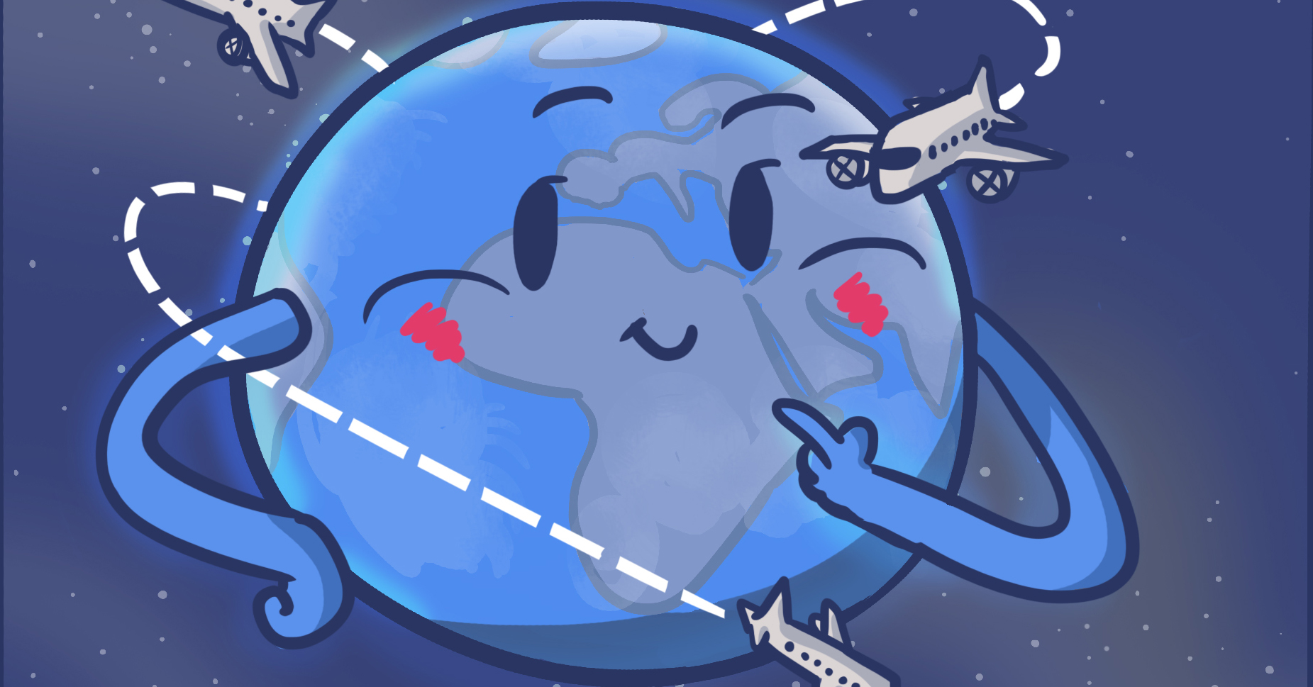
The Canadian federal government is responsible for a number of things that involve other countries. So understanding where countries are in the world is important. This lesson shows us how to read a world map. This will help us understand how the Canadian federal government has to know locations as it works with other countries.
Here are some responsibilities of the federal government that involve other countries.
- Product inspection
- Passports
- Citizenship
When Canadians travel outside Canada, there are checks when entering or leaving a country. A person has to show their Canadian passport to prove their nationality. Being able to read a map while travelling can also make things easier.
Products come from many different countries. Being able to know where these countries are and their geography can help us understand why we need products from other places.
Here are some reasons why knowing how to read a map is a useful skill to learn:
- We can learn distances so we know how far away places are if we need to travel there.
- We can learn about the locations of coastlines in Canada.
- We can discover geographical regions and where populations live.
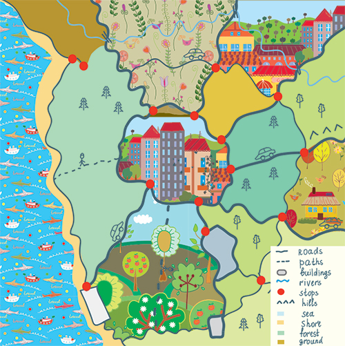
Legend
Maps have legends to help us. A legend displays the meaning of the symbols, colours and styles used to represent geographic information on a map. For example, blue-coloured areas often represent oceans and areas or where there is water, like rivers and lakes. Every map has a legend that gives us information about the places we discover.
See the example shown in the picture.
Latitude and longitude
Look at this world map.
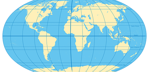
There are lines running across (horizontal). These lines are called latitude.
There are lines that run from top to bottom (vertical). These lines are called longitude.
We use these latitude and longitude lines to find a certain location.
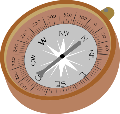
Compass (Cardinal Directions)
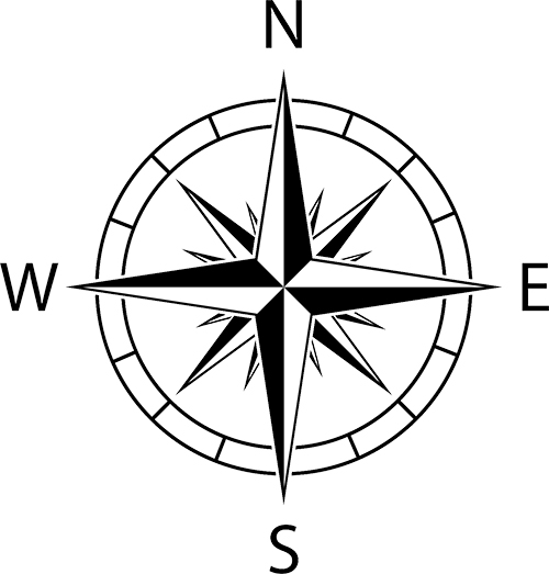
On a map, there will also be a compass that shows the direction. Here is a picture of a compass.
At the top is N for north.
At the bottom is S for south.
On the left side is W for west.
On the right side is E for east.
Sometimes maps give directions to travel in a certain direction as shown on a compass.
Finding a certain location on a map
Sometimes we want to find a certain location on a map.
Latitude and longitude can be used to do that. We are going to learn how to read latitude and longitude.
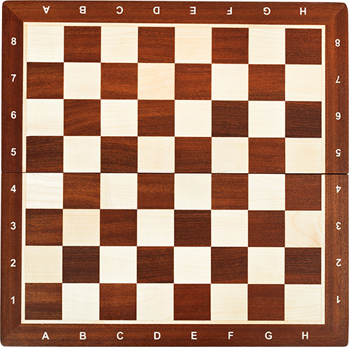
Imagine a board of squares like some people use for a game of checkers.
Notice that the lines that go up and down (vertical) are named after the alphabet (A B C...).
The lines going left to right (horizontal) are named after numbers (1 2 3…).
By finding where a vertical and a horizontal line cross, you can find a certain spot.
Example
Find B6 spot.

- The B column
-
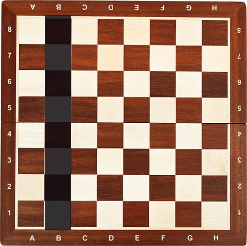
- Row 6
-
- Where the two meet is B6!
-
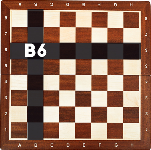
So how do we use this when reading a map?
The column named after the alphabet (A B C…) is the same as the longitude on a map.
The row named after numbers (1 2 3…) is the same as the latitude on a map.

Here is a fun activity to check your learning. Match the meaning with the word.
Finding latitude
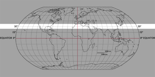
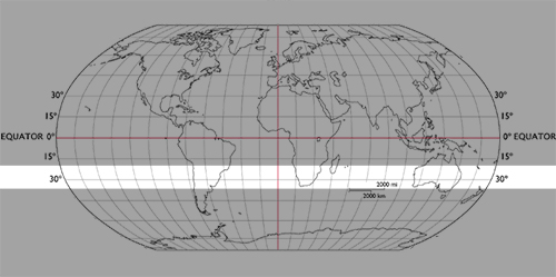
The equator is a line running east and west in the middle of the earth (same as the A B C... rows). The equator is where latitude starts. Latitude 0 degrees is right on the equator. Here’s where it is:
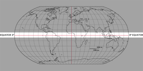
Anything above the equator is measured by the degree and North (or just N. or sometimes it’s just a number).
Anything below the equator is measured by the degree and South (or just S, or sometimes with a minus sign).
So latitude 30 degrees north would be this line (or 30N, or 30).
And latitude 30 degrees south would be this line (or 30S, or -30).
Finding longitude
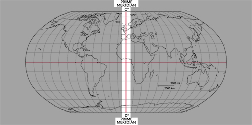
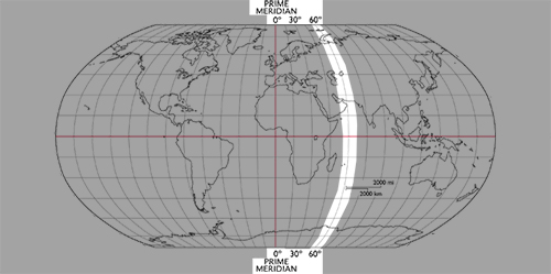
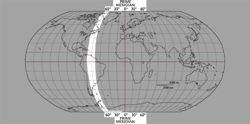
The prime meridian is the line running through London, England. It is perpendicular to the equator. This is the starting point for longitude and longitude 0 degrees. Here’s where it is.
Anything to the right of the prime meridian is measured by the degree and East (or just E).
Anything to the left of the prime meridian is measured by the degree and West (or just W, or sometimes with a minus sign).
So longitude 60 degrees east would be this line (or 60E, or 60).
And longitude 60 degrees west would be this line (or 60W, or -60).
Good learning!
Here’s a fun activity. See if you can do it.
All lessons & quizzes are free!
This was just one of the lessons in our Canada's Three Levels of Government section. There are over 500 lessons on Kids Boost Immunity just like this one on a variety of subjects. Each lesson includes a quiz and every time a student scores 80% or higher on a quiz, we will donate life-saving vaccines to UNICEF Canada. Sign up now!